


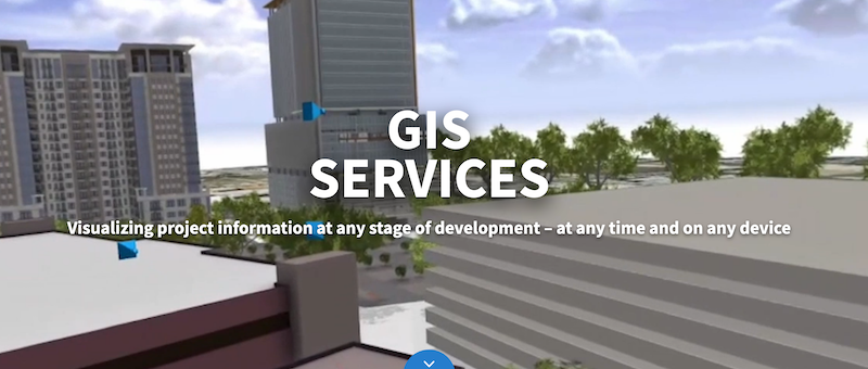
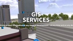
In today’s interconnected world, the fusion of Internet of Things (IoT) and Geographic Information Systems (GIS) is revolutionizing industries by enabling more insightful, data-driven decision-making. The integration of IoT and GIS brings together the power of sensor networks and real-time spatial data, creating a synergy that enhances how organizations understand and manage physical spaces. From optimizing GIS services in Florida cities like Orlando and Jacksonville to supporting smart city initiatives, this article delves into how IoT and GIS integration works, its applications, and its impact on various sectors.
What is IoT and GIS Integration?
At its core, IoT refers to the network of physical devices embedded with sensors, software, and other technologies, which enables them to connect and exchange data with other devices and systems over the internet. GIS, on the other hand, is a framework for capturing, storing, analyzing, and visualizing geographic and spatial data. When these two technologies combine, IoT and GIS integration provides dynamic, real-time insights into spatial phenomena, enhancing monitoring, decision-making, and predictive capabilities.
Through IoT and GIS integration, data collected from various IoT devices, such as environmental sensors, GPS trackers, and smart city infrastructure, can be seamlessly mapped, visualized, and analyzed. This facilitates a comprehensive view of patterns and trends, which can drive informed decision-making across multiple sectors.
How IoT and GIS Integration Works
The IoT and GIS integration process involves several key steps:
- Data Collection: IoT devices capture data in real-time from the physical environment. This could include temperature, humidity, air quality, traffic flow, and more. The captured data often includes location information, which is crucial for spatial analysis.
- Data Transmission: The collected data is transmitted to a central system or cloud platform, where it can be processed and analyzed. IoT technology ensures continuous data flow, which enables real-time monitoring and decision-making.
- Data Processing and Storage: Once the data reaches the central system, it is processed and stored in a way that makes it accessible for further analysis. Here, GIS plays a pivotal role by mapping the data in a spatial format, making it easier to visualize patterns over time and space.
- Data Analysis and Visualization: The integration of IoT and GIS enables the creation of interactive maps and dashboards, providing insights into the spatial dynamics of the data. Analysts and decision-makers can use these tools to identify trends, predict outcomes, and optimize resource allocation.
Applications of IoT and GIS Integration
The use of IoT and GIS integration spans various industries, offering a wide array of applications that improve operational efficiency and enhance user experiences. Below are some prominent examples:
1. Smart Cities
Smart cities are one of the most visible applications of IoT and GIS integration. By using IoT devices to monitor traffic patterns, energy usage, waste management, and public safety, city planners can create responsive urban environments.
Real-time data enables dynamic traffic light adjustments, efficient energy distribution, and timely responses to emergencies. GIS maps layered with IoT data provide a holistic view of the city’s operations, allowing for improved urban planning and resource management.
2. Environmental Monitoring
IoT and GIS integration play a crucial role in environmental monitoring by providing real-time insights into natural resources and environmental conditions. For example, IoT sensors placed in rivers, forests, and agricultural fields can monitor water quality, soil conditions, and air pollution levels.
GIS can then map this data to identify areas of concern, predict environmental impacts, and facilitate conservation efforts. This integrated approach is invaluable for organizations focused on sustainability and conservation.
3. Supply Chain and Logistics
In logistics, IoT and GIS integration enhances asset tracking, route optimization, and inventory management. IoT sensors on vehicles and containers can provide real-time information about location, temperature, and even the condition of goods.
GIS can map this data to optimize delivery routes, predict delays, and improve supply chain visibility. The integration of IoT and GIS helps businesses streamline operations, reduce costs, and increase customer satisfaction by ensuring timely deliveries.
4. Agriculture
IoT and GIS integration is transforming agriculture by enabling precision farming. IoT sensors can monitor soil moisture, crop health, and weather conditions, providing farmers with actionable insights into when to irrigate, fertilize, or harvest crops. GIS maps can then display this data, allowing farmers to visualize crop health over time and make informed decisions. This technology-driven approach to agriculture helps maximize yield, reduce waste, and promote sustainable farming practices.
5. Disaster Management
During natural disasters, IoT and GIS integration can be critical in coordinating emergency responses. IoT devices can provide real-time data on weather conditions, water levels, and structural integrity of buildings, while GIS can map this information to identify affected areas and coordinate rescue operations. This technology combination enhances situational awareness, improves response times, and ultimately saves lives.
Benefits of IoT and GIS Integration
The integration of IoT and GIS offers numerous benefits that go beyond traditional data collection and analysis. Here are some key advantages:
Real-Time Decision-Making
By combining real-time data from IoT devices with spatial analysis from GIS, organizations can make timely decisions based on current conditions. This is especially important in sectors like public safety and environmental monitoring, where rapid response can significantly impact outcomes.
Enhanced Data Accuracy
IoT sensors continuously collect data from the physical environment, providing a more accurate and comprehensive dataset for analysis. GIS complements this by offering spatial context, which adds an extra layer of accuracy and relevance to the information collected.
Predictive Capabilities
The integration of IoT and GIS allows for predictive analysis, enabling organizations to anticipate future trends and events. By analyzing historical data alongside real-time information, businesses and governments can forecast demand, predict risks, and optimize resource allocation.
Improved Resource Management
IoT and GIS integration facilitates efficient resource management by providing insights into asset usage and availability. For example, in a smart city setting, this could mean optimizing energy consumption, improving water distribution, and reducing waste. The ability to monitor and manage resources in real-time helps organizations reduce costs and improve sustainability.
Challenges and Considerations
While IoT and GIS integration offers significant benefits, it also comes with challenges that organizations need to address. Some common considerations include:
Data Security and Privacy
IoT devices often collect sensitive data, raising concerns about data security and privacy. Ensuring robust security measures and complying with data protection regulations are essential to protect against potential threats and maintain public trust.
Infrastructure and Scalability
IoT and GIS integration requires a reliable infrastructure capable of handling large volumes of data. Organizations must invest in scalable solutions that can support growing data needs and accommodate future expansions.
Data Quality and Integration
Ensuring data quality is crucial for accurate analysis. IoT devices must be calibrated correctly, and data integration processes must be well-managed to prevent inaccuracies. Additionally, the integration of IoT and GIS requires interoperability between different devices and platforms, which can pose technical challenges.'
The Future of IoT and GIS Integration
As technology advances, the integration of IoT and GIS will continue to evolve, offering new opportunities for innovation and efficiency. Emerging trends such as 5G, artificial intelligence, and edge computing are expected to further enhance IoT and GIS capabilities, enabling faster data processing, improved connectivity, and more sophisticated analyses.
IoT and GIS integration is poised to play a critical role in shaping the future of smart cities, environmental conservation, and many other sectors. As organizations embrace this powerful combination, they will unlock new levels of insight, efficiency, and responsiveness, paving the way for smarter, more sustainable solutions.
Conclusion
The integration of IoT and GIS is transforming industries by providing real-time, spatially aware insights that drive smarter decision-making. From optimizing urban infrastructure to monitoring environmental conditions, IoT and GIS integration is helping organizations better understand and manage their physical spaces. As the technology continues to evolve, its potential to create positive change will only grow, making IoT and GIS integration a vital tool for the future.
Easy Branches Global Guest Posting Services in multi languages
Best last minute News headlines from Your Country and inborn language
Yachts News | Discover the Exclusive World of Yachts
Yachts Listings for Sale and Charter
immediate for delivery New Exclusive Hyper, Mega, Classic and Super sports Cars


